Funding: JW Sefton Foundation (Mission Trails, Tijuana Estuary), San Diego River Park Foundation (Boulder Creek), United States EPA (Tijuana River)
Team resources (lab and field protocols)
Impaired water quality threatens human health and ecosystems. Contamination events, including from sewer system overflows, can be difficult to predict, and yet there are few real-time water quality monitoring stations in the San Diego-Tijuana Border region. We are developing systems to monitor water quality in real-time using telemetry and advanced water quality monitoring systems. The monitoring system includes standard water quality parameters (pH, conductivity, dissolved oxygen, temperature) but also chromophoric dissolved organic matter (CDOM) and tryptophan, which correlates with bacteria concentrations in other water bodies (as documented by Natalie Mladenov’s lab here).
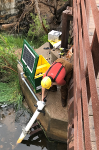
 Left: Ben Downing installing the Manta sonde in the San Diego River at Mission Trails
Members of the Biggs and Mladenov Labs have installed water quality sondes and pressure transducers to measure stream level on Boulder Creek (ended April 2019), San Diego River at Mission Trails (2019-present), Tijuana Estuary (February 2021) and Tijuana River (October 2022). The systems report the data in real-time via HPWREN. See the Online Data and Summary Story of the Boulder Creek Project. Our most recent project includes a new sonde in the main stems of the San Diego River, Tijuana Estuary and Tijuana River. Real-time photos of the Tijuana Estuary site is here and archived videos here.
Hollister Street site real-time data here.
Tijuana Reserve data: tijuanariver.trnerr.org for more real-time data, including water levels in the ocean (La Jolla) and Oneonta here. Historical water quality and both real-time and historical WQ/nutrient data (Centralized Data Management System) here and tidal information here for the Tijuana Estuary.
We have developed a remotely-operated vehicle (ROV) boat with the San Diego Argonauts. See the how-to video here.
We have developed how-to videos for setting up a Mayfly datalogger with Clarivue turbidimeters…see the EnviroDIY page here.
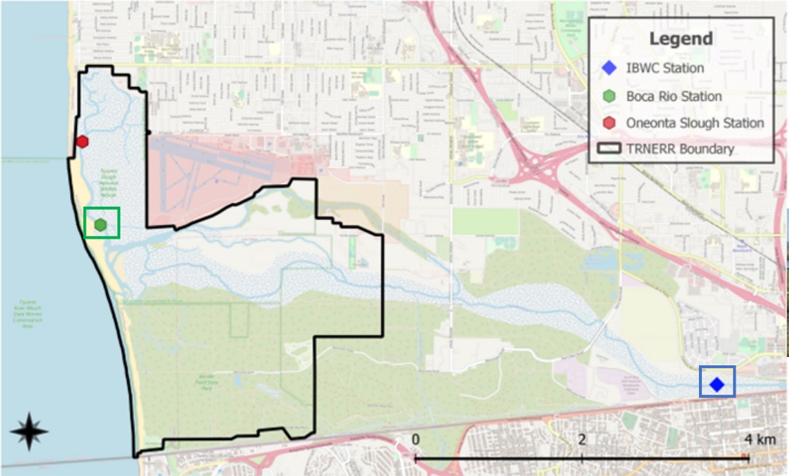
Location map of the two monitored locations on the Tijuana River (IBWC Station) and Tijuana Estuary (Boca Rio Station):

Hourly precipitation forecasts at: San Diego Mission Trails; Tijuana River. National quantitative precip forecast. Real-time weather maps for San Diego here and radar here. River flow forecasts for San Diego river here.
Resources for project participants here.
Publications and presentations
2023-02-07: San Diego Estuaries Research Symposium
News articles on the sewage crisis along the border:
Jan 11, 2024: Mexico breaking ground on treatment plant upgrade.
Aug 4, 2022: Ruptured pipeline in Smuggler’s gulch
March 27, 2024: Federal funding approved for sewage collection and treatment upgrades.
July 15, 2024: Construction underway on sewage projects. Includes timeline of progress for 2024.
October 30, 2024: Water Board reports (10/02/24 and 9/5/24 address the TJR)
November 4, 2024: Monitoring the Tijuana River, Environmental Monitor
Nov 21, 2024: Oceanside fined $1.5m for 2020 sewage spills (total 1.8m gallons)
Dec 2024: Cuidad Septica: Origins of wastewater in Tijuana
June 2025: NASA report on SDSU’s work on plume mapping
